Upper Catchment Tributaries Flood Study
Published on 22 August 2025
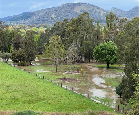
Have you experienced flooding in the Delatite River, Howqua River and Upper Broken River catchments?
Community members are being invited to share their local knowledge and experience of past flood events, which will be used to cross-check a new flood study being conducted by Council.
Following another recent flood study covering the Mansfield township, the new study aims to fill critical knowledge gaps along the Delatite, Howqua and Upper Broken river systems. No formal studies covering these rivers have been done before. The current project will improve Council’s data-based knowledge of how floods behave across these areas, leading to better planning decisions, emergency response and community preparedness.
Mayor Cr Steve Rabie said that local knowledge was critical for confirming the accuracy of flood modelling.
“We can use data to model flood events and predict what locations will be affected, but our community’s experience of past events is what we really need to make sure the model matches reality,” he said.
“If you have photos, videos or just a memory of where the water has been up to in the past, please get in touch and share that with us,” Cr Rabie said.
Community members’ knowledge will be used by specialist consultant Venant Solutions to help confirm and improve the flood modelling and mapping being developed.
"By combining technical modelling with the experience of locals who really know what happens on the ground, we can make sure our flood study gives a reliable picture of what locations are at risk," Cr Rabie added.
"Once we have that information there’s a lot we can do to protect our communities proactively, making our Shire more resilient,” he said.
The project is a collaboration between Council and the Goulburn Broken Catchment Management Authority and is funded by the Australian Government in partnership with the States and Territories under the National Partnership Agreement for Disaster Risk Reduction.
To share your knowledge or experience go to engage.mansfield.vic.gov.au. Community members can complete an online survey or pin locations an interactive map to identify locations that have flooded in the past. Feedback can also be given by email to council@mansfield.vic.gov.au.
Feedback for this initial consultation stage closes on 12 September.